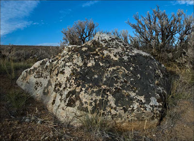
Ice-rafted erratic resting high above Columbia River at Ginkgo Petrified Forest State Park near Vantage, WA.
Erratic: "A rock fragment carried by floating ice or the icesheet itself, deposited at some distance from the outcrop from which it was derived and generally composed of a different type of rock than the local bedrock"
Most of eastern Washington has been covered by Columbia River Basalt Group lava flows. The floods of basaltic lava were followed by catastrophic outburst floods of water from Glacial Lake Missoula and other sources. One of the most interesting features left by these floods are out-of-place "erratic" boulders transported in icebergs from northeastern Washington, Idaho, Montana and even parts of Canada. Most of the erratic boulders contrast the black/brown basalt bedrock.
Part I of this post includes photos and information about Ginkgo Petrified Forest State Park along with links to other related sites.
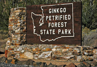
All but two photos in this post were taken during a hike on 6 December, 2008. The image of Ginkgo S.P. sign and shot of pillow basalt contributed by Nick Zentner were taken several years ago.

One of six panels recently placed near the Ginkgo Petrified Forest interpretive center to help visitors understand the Ice Age Floods that swept over the Vantage area. The park certainly is an "Iceberg Graveyard".
Washington State Parks made a great move when they teamed with artist Stev Ominski to develop new Ice Age Floods interpretive panels for many of the parks. His illustrations of the Ice Age Floods do so much to tell the story of the floods and help all of us to "see the water".

Westbound truck climbs Interstate 90 between Vantage and Ellensburg. Ice-rafted erratic in foreground.

The lichen and moss patterns on some of the erratics are interesting. I'm not quite ready to start reading about those guys.

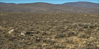
Ice-rafted erratics and debris are scattered from one side of this image to the other. A large iceberg melted at this location.

The many smaller stones, gravel and sand that are found between erratics in clusters and bergmounds don't show up very well in most of my photos. Some of the material is very colorful and reminds me of river gravel I've admired in Idaho and Montana.

Erratics and iceberg debris between Ryegrass and Schnebly coulees at a location known as Iceberg Pass.

Schnebly Coulee Erratics. Large erratic near the top of this image is featured in the next shot.


Arrow notes erratic boulder. Small group of mule deer is also shown.

 Nice table-top erratic above area known as Hell's Kitchen. View looking east over Columbia River channel.
Another shot showing smaller stones that accompanied larger erratics on their journey.
 Looking north from ridge between Schnebly Coulee and Hell's Kitchen. The Cayuse Creek drainage (Last week's hike in Part I of this blog) is on the other side of high point in the distance.
The town was moved to its present location during construction of Wanapum Dam in the early 60's. This photo shows part of the original highway that crossed river. Prior to dam construction, the bridge that currently spans the Snake River at Lyons Ferry was in place at this crossing. On the east side of the bridge the road followed the river's edge north to Frenchman Coulee. "Part I" of this post shows two images of the highway in Frenchman Coulee.

Ash layer from 1980 Mount St. Helens eruption along Old Vantage Highway.

So many ice-rafted rocks are laying around this park that some have been put to work. Arrow points to erratic being used to hold a sign post. Inset image shows erratic that's been tossed into rock crib anchoring section of park boundary fence.

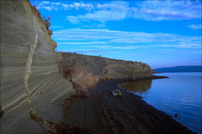
I parked at sunrise in the Wanapum State Park swimming beach lot (no problem finding a space on December morning). A short walk down the trail shown in image leads to the Clastic Dikes found in a large deposit of plane-laminated sand. Note erratic in foreground and Sentinel Gap in the distance. Arrow marks one of the Clastic Dikes.
The Ice Age Floods Institute's Glossary of Technical Terms Related to the Ice Age Floods defines a Clastic Dike as:
"A feature that cuts across bedding structures and is composed of the sedimentary material it transects. Believed to be the result of fracturing and sediment movement due to earthquake shaking during or soon after cataclysmic flooding."
The face of this deposit seems fairly stable but please use caution if you visit.

The unusual clastic dikes in central and southeastern Washington State appear in slackwater deposits left by the Ice Age Floods. Geologists believe these features are produced by seismic disturbance of saturated sediments.
"They probably formed as a result of ground shaking, which caused the wet sediments to flow down into or up along vertical earthquake-generated cracks in the flood deposits."
Bjornstad
Clastic dikes found in the Mid-Columbia Basin reach to the top of flood deposits, leading geologists to believe that an earthquake occurred during or soon after the last Ice Age Flood event.
In his book "On the Trail of the Ice Age Floods" Bruce Bjornstad describes Clastic Dikes and gives driving directions to some amazing exposures in the Mid-Columbia Basin. Two locations Bruce describes that I especially enjoyed visiting are: The clastic dikes found in the Touchet Valley and those near Starbuck.

Maybe not the best example. This wild looking thing is probably the most unusual clastic dike I've photographed. A clastic dike just a few yards from this one is as straight as any vertical line I could draw.
Note from Tom: I wouldn't recommend a special trip to visit clastic dikes but they are an interesting feature to enjoy if you're in the Vantage, Touchet or Starbuck area.

The fissures are filled with sand, silt, clay, and coarser debris. Thin clay and silt linings separate the margins and internal layers. -Fecht
The lack of slackwater silt in the material adjacent to these Clastic Dikes tell geologists the water was moving too fast to allow the fines to settle out before all the water escaped.

Find this stuff and you've found an ancient lake or river location. Where lava flowed into water, pillow basalt and palagonite were created.

Photo by Nick Zentner, President of the Ellensburg Chapter of the Ice Age Floods Institute. The cowboy hat is a nice touch Nick!

I've tried not to post too many shots taken around the Interpretive Center. I hope you'll explore the exhibits in person. Large petrified logs surround the building and the petrified wood collection on display inside is amazing.
Be sure to inquire about Interpretive Center hours of operation before traveling to visit. I would like to mention that long hikes in the summer at this park are probably not a great idea. Spring and fall are the best times to hike in this part of the state. If you're not familiar with the area, please take time to visit with a Park Ranger prior to hiking in the park.


2 comments:
Tom: These continue to be excellent posts. Thanks for taking the time to create them. I will be using them in my teaching...
Gordy Caswell: I will soon begin my second season working at the Ginkgo Interpretive Center and the information on this site will give me more tools to draw on while conducting tours and talking with park visitors.
Thank you!
Post a Comment