Tuesday, November 25, 2008

Spring Coulee (East Rim)

- Click any image to expand -


Looking northwest to Billy Clapp Lake from road.
Farming operation above trimline - top left.


No violations today ... I was unarmed and alone.

Last month I posted a few photos and text after a hike down the west side of Billy Clapp Lake.

See: Billy Clapp (West Side)

As I walked the west side in October, I was looking through binoculars at some of the flood features above the east shore and decided that I'd need to get a closer look. Saturday I noticed that Accuweather had a sunball symbol on Sunday ... So off I went (I wish I'd have looked at the numbers they had next to the sunball). When I started hiking it was 18 degrees ... Gloves and a warmer coat would have been nice.

The approach I took is described by State Fish & Wildlife as: "A primitive parking area on the east side of the Billy Clapp Reservoir that is about two miles from the west end of county Road 26 NE off of county Road Q NE."


No shortage of deer between Wilson Creek and Billy Clapp Lake.

I was surprised at the number of deer, ducks and geese I saw during my hike. The State doesn't seem to think much of the area as a refuge. Paragraph below from Washington State Department of Fish and Wildlife site. The two-page ownership map it provides is pretty good. - See link below.


Billy Clapp area ownership map

Columbia Basin Wildlife Area

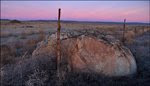
The Billy Clapp Lake unit is 4,000 acres along what was originally called Long Lake Reservoir but renamed in honor of one of the originators of the Columbia Basin Irrigation Project. The natural coulee was dammed on the lower south end (Pinto Dam) to create the reservoir. Water cascades into the upper end of the reservoir from the Main Canal creating Summer Falls. Basalt cliffs of varying heights encompass the reservoir. Most of the shoreline is too steep and rocky to support wetland or riparian vegetation, and the uplands are a mix of poor quality gravelly soils and basalt outcroppings. Vegetation varies from the fire-caused cheatgrass or bunchgrass communities to native woody shrubs on talus slopes. BOR maintains public parking, and boat launching is available on the north end of the lake. The Stratford Game Reserve encompasses nearly all the public land in this unit. Originally designated to provide a resting area for migrating waterfowl each fall, public use and changing migration patterns have made the Game Reserve less effective.


From the Grand Coulee

THREE ICE AGE FLOOD CHANNELS


Not all of the Grand Coulee flow entered the Quincy Basin via Lower Grand Coulee. Water that escaped the Grand Coulee cut channels around High Hill and Pinto Ridge. These channels carried substantial flows and became known as Dry Coulee and Spring Coulee (The reservoir created in Spring Coulee is today named Billy Clapp Lake). Floodwaters flowing through Spring Coulee fed into the Crab Creek channel prior to entering the Quincy Basin.

As stated in the October post - J Harlen Bretz called Spring Coulee:

"A fine scabland canyon with castle-like buttes, lateral subsidiary canyons, and cataracts notching its walls"


Bureau of Reclamation Benchmark.

Between 1946 and 1948 the Bureau of Reclamation constructed Pinto Dam at the south end of Spring Coulee. The Coulee is one of many Ice Age Flood features used by the Bureau as part of the Columbia Basin Irrigation Project.


Surveyed by the USBOR 10 years prior to Pinto Dam construction.

It was pretty cool to take a few minutes and think about the surveyors walking the Ice Age Floods region in the 1930s. In his book "Grand Coulee Harnessing a Dream"- Paul C. Pitzer describes the surveyors searching the channeled scablands of eastern Washington for potential storage reservoirs, dam sites and canal routes.


Benchmark - GPS

N 47°28.910'

W 119°14.530'

The features I was most interested in on this side of the coulee were several potholes and a group of "Drumheller" type channels just east of the potholes.

The potholes were formed during the Glacial Lake Missoula flood events that swept over eastern Washington as recently as 15,000 years ago. Powerful whirlpools (sometimes referred to as underwater tornados) known as kolks, scoured out these holes.


WIKIPEDIA DEFINES KOLK: (also known as colc) is an underwater vortex that is created when rapidly rushing water passes an underwater obstacle in boundary areas of high shear. High velocity gradients produce a violently rotating column of water, similar to a tornado. Kolks are capable of plucking multi-ton blocks of rock and transporting them in suspension for some thousands of meters.

In his book "On the Trail of the Ice Age Floods", Geologist Bruce Bjornstad explains the creation of Rock Basins and Potholes: "Fast-moving floodwaters passing through scabland channels further gouged into the basalt, scouring out rock basins and augering deep holes into basalt. Like a powerful vacuum cleaner, floodwaters actually sucked up all the loose material off the land surface, including huge columns of basalt, taking advantage of any weakness in the rock, such as fractures."


Google Earth image with pothole ID numbers I'll use below.

To view image of pothole #4, you'll need to open the October post and scroll down to the pothole image.


Remember ... You can click image to enlarge.


Pothole ID #1

The picture doesn't do this pothole justice. This is one fine pothole! I'll return in the spring and try to get a better shot as the scale just doesn't show here.


Pothole ID #2


Pothole ID #3

During our lunch stop on the October trip, we noticed a "hanging pothole" on the other side of the coulee. Erosion of the main channel has opened up one side of the pothole. Future megafloods will finish the job and remove all traces of this pothole before going after potholes #1 and #2.


Many shallow potholes are found in this area.

These smaller kolk carved basins seem popular with the local wildlife. Game trails lead to each of them.


I'll embed a Google Map at the bottom of this post. If you switch the map from Terrain (TER) to Satellite (SAT) and zoom in, you'll be able to search the area and find many more potholes on the bench east of Billy Clapp Lake.


Several nice mesas near the lake.


A smaller version of "Hat Rock".


Hard to hide with those pointy things sticking out of your head.


Google Earth image shows Giant Current Ripples above Billy Clapp Lake


For scale you can open the October post where I posted an image of Bruce Bjornstad standing on one of the ripples shown in this shot. The mix of farmland, ripples and a massive flood channel remind me of a similar spot closer to home ... see photos below.


Giant Current Ripples in Washtucna Coulee
-
Note farmer on tractor at top left.


Same shot but a little wider angle. Huge flood bar being removed at coulee floor. If you look to the right of the quarry there seems to be one ripple mark left.

Another set of Washtucna Coulee giant current ripples


Borrow pit in ripple-covered flood bar exposes layer of windblown loess deposited since the Ice Age Floods.


South of the coulee along Highway 28 a historical marker gives a brief history of the area:

HISTORY OF THE STRATFORD AREA

Indians camped along Crab Creek in Stratford to gather roots and other food. The main Indian trail came past Stratford across the creek. The Indian trail branched here & one went past Pinto Dam. LT Symons came past here while laying out military wagon road from FT Walla Walla to Camp Chelan in 1879. Old wagon road from Waterville to Ritzville came past here in 1888. Railroad built in 1892. Early apple orchards were irrigated from Brook Lake in late 1890's. Pumphouse still standing. Stratford platted in 1903. Crab Lake drained by local pioneers in 1909 for farming purposes.
Grant County Historical Society

Sunday, November 16, 2008

Wallula Gap (West)


Several photos here taken during yesterday's hike to the Wallula Gap Overlook. I hiked from the north to a geocache described in "On the Trail of the Ice Age Floods". Last month I posted a few comments, photos, and links related to Wallula Gap in this blog. The granite boulders near Wallula Gap were rafted more than 100 miles by icebergs during the Ice Age Floods.

Update: The new Hanford Reach Interpretive Center is now open and a good place to learn more about Wallula Gap and the Ice Age Floods that swept through the Pasco Basin.

Wallula Gap viewed from north.
Wallula Gap viewed from Highway 12. This hike was to the highest point on the right (elev. 1,140'). During the largest Ice Age Floods the high point was under eighty feet of water.

Small Wallula Gap area erratic.
You don't walk far around here before running into well-travelled rocks.

Erratic boulder ice-rafted during the Ice Age Floods.
At the 1,100 ft level, a large granodiorite erratic rests more than 760 feet above the Columbia River. This erratic is featured in video clip below.

November wildflowers at Wallula Gap.
Wallula Gap wildflowers blooming on the 15th of November.

The
View across Wallula Gap to the Two Sisters.

Wallula Gap summit above the Columbia River.
The "summit" area is pretty cool on this side of Wallula Gap. I'll leave those photos out so you can see for yourself when you make the trip. Don't forget to look for the geocache. This shot does show the highpoint. With just a 20-second timer on my camera, these shots can be a race.

Ice Age Floods erratic exposed near Wallula Gap.
Some of the erratics are only partially exposed.

Erratics rafted by Icebergs during Ice Age Flood events.
As you walk the 5-7 miles this trip involves, you'll probably be amazed at the number of small ice-rafted erratics scattered over the terrain.


Wallula Gap Barge Columbia River
Trains, trucks and barges all use Wallula Gap

Dams, locks and dredging have created a deep shipping channel on the lower Snake and Columbia rivers between Lewiston, Idaho and the Pacific Ocean. Wheat, is the main product shipped from the interior. Redredging work maintains a channel about 5 feet deeper than the Mississippi River system allowing barges twice as heavy to operate. The construction of the dams brought numerous benefits and several negatives, among them the flooding of many features created by the Ice Age Floods.


Wallula Gap photo taken in the spring.


Spring is the best time to explore this area, balsamroot and other wildflowers put on quite a show. View looking NE into the Pasco basin. This is a great spot to get a feel for the depth of Lake Lewis.


The short video clip below - Shows large erratic pictured above in relation to Two Sisters on the other side of Wallula Gap. Click arrow to view.


View Larger Map


Blue marker shows - Wallula Gap Overlook

Sunday, November 9, 2008

Palouse River Canyon Hike

Ice Age Floods Institute members hiking in the Palouse River Canyon.
Palouse River Canyon Hike

-Click any image to expand-

A hike in Ice Age Floods region that I always enjoy is the walk from Lyons Ferry at the confluence of the Palouse and Snake rivers to the Palouse Falls overlook. For several years I'd wanted to explore the Palouse River Canyon but wasn't sure about land ownership so I viewed the canyon from the Palouse Falls overlook and the road (SR-261).

One evening I was talking with Dale Middleton and he mentioned that Lloyd Stoess was leading a hike through the canyon and provided me with contact information. A few days later I was following Lloyd and a large group of Ice Age Floods enthusiasts into the Palouse River Canyon.

The trip distance is about eight miles with several ups and downs. Lloyd does a great job and describes the geomorphology, geology, botany, zoology, Ice Age Floods, early Indian history and local families that have lived and worked in the area for years.

During the Glacial Lake Missoula flood events, Washtucna Coulee was filled beyond capacity. Water began to spillover to the south carving out the spectacular Palouse River Canyon.

Geologist Bruce Bjornstad describes the canyon a "Chaotic maze of coulees, recessional cataracts, abandoned spillways and buttes".

Saturday was the third time I've tagged along on Lloyd's hike ... and even though the weather wasn't the greatest with off-and-on rain, I sure enjoyed the day.


Geologist Bruce Bjornstad, Gene Kiver and local history expert Lloyd Stoess.
Bruce Bjornstad, Gene Kiver and Lloyd Stoess

With his background in geology and understanding of the local history, Lloyd could easily lead these trips by himself but adds two more experts to the mix: Bruce Bjornstad author of "On the Trail of the Ice Age Floods" and Gene Kiver - Professor Emeritus of Geology at Eastern Washington University and Ice Age Floods Institue Executive Committee member.

On this hike you only take a few steps off the pavement before stopping so Lloyd can begin to give you a taste of the incredible history that has taken place in the immediate area. In 1805 the Lewis and Clark expedition visited this site on their trip west.


Lewis and Clark Visit - Nobody's Home


When the Lewis and Clark expedition arrived at the mouth of the Palouse River in October of 1805 they found the village of Palus. The village that appeared to be a "great fishing place" was empty as the Palouse Indians had traveled to the Blue Mountains to gather roots/berries and hunt. After (as Lloyd puts it) "Borrowing a few things" the expedition continued downstream to the confluence of the Snake and Columbia Rivers where many Indians were gathered.

At the camp along the Columbia River, Lewis and Clark presented a Jefferson Peace Medal to at least one Native American leader. In 1964 a Jefferson Medal was recovered during the excavation of a cemetery at the confluence of the Palouse and Snake rivers in Franklin County - The starting point of today's hike.

Link to the story of the Jefferson Peace medal at Palus:Jefferson Peace Medal

You might have the coin pictured above in your pocket.
In 2004 the U.S. mint released a series of coins that commemorates the 200th anniversery the Louisana Purchase. The "tails" side of the first coin in the series features the Jefferson Peace Medal.

Link to U.S. Mint site that describes the: Peace Medal Coin

John Clarke of the Pacific Fur Company

In may of 1813 John Clarke of the Pacific Fur Company arrived at the confluence of the Palouse and Snake Rivers (Called Pavion and Lewis rivers at the time). During the visit a silver goblet owned by Clarke was stolen. The theft of the goblet resulted in Clark ordering one of the Palus Indians to be hung on a gallows constructed with the poles of his own lodge. Word of Clarke's action quickly spread through the various tribes in the Mid-Columbia region.

Soon after the violent act, Alexander Ross recorded the words of Tummeatapam (Chief of the Walla Wallas) - "What have you done my friends. You have spilt blood on our lands."

Learn more about the ramifications of Clark's violent act by searching: Fur Trade Historical Documents

Lyons Ferry and the Mullan Road


Lloyd always does a great job explaining Lyons Ferry that was in operation at this location for 108 years (under several names) and points out that it was part of the Mullan Road constructed in 1858.

Lewistion Tribune story: A River Runs through the Lives of Lyons Ferry

Woolly Passengers on Lyons Ferry:
Every year, rancher Mervin DeRuwe crossed 2,000 to 3,000 sheep at a penny a head. The operation took two to three days and required a chase boat to fish out sheep that jumped overboard. -Lewiston Tribune

Ice Age Floods Institute members viewing the Marmes Rockshelter site.
Viewing the Marmes Rockshelter Site

The Marmes Rockshelter is one of the most important archaeological sites in the Pacific Northwest, unfortunatly the site is now underwater, a result of the construction of Lower Monumental Dam on the Snake River. Evidence obtained at the site suggests human activity in the area dating back more than 11,000 years.

Marmes Rockshelter (HistoryLink)

Marmes Rockshelter (NWC)

Marmes Rockshelter (Wikipedia)

Inspecting a cave carved by the Ice Age Floods.

The Ice Age Floods sculpted several nice caves in the canyon. These caves always seem to be a popular stop on the hike. Some of the matting used by Native Americans can still be found in the caves. It was apparently used to cover and protect their food cache. It is believed that the caves were used as storage areas rather than dwellings.

Ice Age Floods carved cave.
View from cave.


Palouse River Canyon hikers lunch break.
Lunch break on the trail of the Ice Age Floods.


Palouse River Canyon gravel bar.
Here's a shot for Gene

Gene Kiver seems to appreciate a nice gravel bar. This shot was taken in the spring and shows a large tongue shaped gravel bar just below Saturday's lunch stop (marked as "L"). Note the buttes in the distance.

Palouse River Canyon Buttes, shaped by the Ice Age Floods.
Palouse River Canyon buttes

These huge buttes are my favorite Ice Age Floods features in the lower canyon.

Palouse River Canyon - view looking north
Looking upstream Palouse River Canyon

According to a story of the Palouse tribe, the Palouse River once flowed smoothly into the Snake. But four giant brothers, in pursuit of a mythic creature called "Big Beaver" speared the great creature five times. Each time Big Beaver was wounded, he gouged the canyon walls, causing the river to bend and change.
The fifth time he was speared, he fought the brothers valiantly and tore out a huge canyon. The river tumbled over a cliff at this point to become Palouse Falls. The jagged canyon walls show the deep marks of Big Beaver's claws. -From WA State Parks site


Palouse Falls viewed from the State Park overlook.
Almost dark when we arrived at the falls.


Washington State Parks Ice Age Floods interpretive panel.
J Harlen Bretz interpretive panel.

The new Ice Age Floods interpretive panels recently placed by the Washington State Parks department sure look nice. This one shows a high altitude view of the scablands and J Harlen Bretz who was the first to push the idea of catastrophic flows of water shaping the Channeled Scablands. If you click to enlarge image you might be able to see the mention of James Gilluly. One of Bretz's critics that "saw the light" when he visited the Palouse River Canyon.

Palouse Falls State Park
Click below for directions to Palouse Falls State Park.


Palouse Falls State Park

I should mention that Lloyd and Gene are members of the Cheney-Spokane chapter of the Ice Age Floods Institute. If you live in that area I would encourage you to attend one of their chapter meetings.

Cheney-Spokane IAFI Contact Information


Thanks for the great trip Lloyd!!! See you in the spring.

Tom

Tuesday, November 4, 2008

Potholes Coulee Ellensburg IAFI Field Trip

Click any image to expand

Nick Zentner describes the formation of Potholes Coulee.
On Sunday 2 November 2008 - The Ellensburg Chapter of the Ice Age Floods Institute's President/CWU geologist Nick Zenter (center) led a field trip to Potholes Coulee and the West Bar overlook on Babcock Bench. These are two of the most amazing features along the path of the Ice Age Floods. This was the fourth field trip of 2008 for the Ellensburg Chapter.

Email from Nick:

Ellensburg IAFI enthusiasts -

In a light drizzle, 47 brave folks appeared at CWU's Hebeler Hall parking lot yesterday (Sunday, Nov 2) to carpool to Potholes Coulee near Quincy. Their reward? Sunshine, no wind, and temperatures in the mid-60's at the coulee! Thanks to all that participated. Our next field trip will be in April. Our next lecture will be Wed, December 3 in Hebeler Hall room 121. Details coming soon...


Comment from Tom: Nick- You forgot about the three of us that met up with the group in Grant County (Karl, Bill and Tom) ... so I think the offical count was 50 +2 dogs.


Potholes Coulee -Bruce Bjornstad image

The first stop was on the north rim of the coulee. At that location Nick described the basalt flows and formation of Potholes Coulee. The second stop was out of frame to the north - on Babcock Bench at the West Bar overlook. Yellow line marks trail the group followed to the final lecture location on the coulee floor.


Nick made arrangements with a landowner on the north rim of the coulee for the group's first stop.


Professor Karl Lillquist (CWU Geography and Land Studies Department) displays a 1910 U.S. Geological Survey topographic map of the Quincy Basin.

Karl told the story of J Harlen Bretz being intrigued by what he saw on the map -- huge canyons and cliffs that had once been waterfalls -- at an elevations high above the Columbia River.


Bretz's Flood


In his new book Bretz's Flood - author John Soennichsen describes the 1910 trip 27-year-old J Harlen Bretz made to the Univeristy of Washington's Department of Geology to view the new Quincy Quadrangle map:

"For hours, Bretz poured over the abandoned cataracts, huge pothole depressions, and overhangs of exposed rock he saw in the swirl of lines this map comprised. Although at that time geology was merely an avocation for Bretz, he could clearly see that some unusual event had happened here at some point in the distant past."


Nick describes the Columbia River Basalt Group, Glacial Lake Missoula and the formation of the Channeled Scablands.

Link to USGS Channeled Scablands page.


Walking up to the West Bar overlook on Babcock Bench is always a stunning experience.


Nick couldn't have picked a better spot to describe depositional features created by Ice Age Floods. The giant current ripples and the massive gravel deposit underneath Trinidad are amazing.


This shot of the giant current ripples on West Bar was taken at sunset in June.

The group sure seemed impressed with the ripples on a fall afternoon but I've got to mention that they're much more impressive on a summer evening.
(I've had to walk around rattlesnakes in this area a couple times - Watch where you step if you visit during warmer months).


How big are those ripples over there?

Click on the image to enlarge and check out the guy standing on one of the largest ripples. This image was taken two years ago during a visit to West Bar.


Karl did a great job explaining how the Ice Age Floods took apart the basalt and also described depositional features on the coulee floor.


Nick recaps the day during a rest stop at the west end of the coulee mid-rib.


Thought I'd add this aerial that was taken a few miles south of the area we visited Sunday. This shot gives us a pretty good look at Babcock Bench. If you click the image to enlarge you'll notice West Bar.