On December 23rd, I visited Palouse Falls and posted photos of the frozen falls on this blog. When temperatures warmed in early January, I made another trip out to the falls - What a difference 50 degrees can make!
I'll add a few images here, but check out Palouse Falls in Winter Part II at HUGEfloods.com for more photos, large format video and streamflow information.
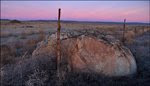
Snow and ice 18 days earlier. Starting to look like spring.
Video recorded on 10 January 2009. Palouse Falls and Kelly Underwood's jetboat is shown. Underwood launched his boat in the Snake River and navigated the lower Palouse River Canyon to reach Palouse Falls plunge pool.
Suspended sediment in the swollen Palouse River gives a clue to the color of Ice Age Flood flows.
Photo taken the same day from river level courtesy of Kelly Underwood. A few days after I posted the Palouse Falls video on Youtube, I received a couple photos from the Jetboat pilot - Kelly Underwood (Dayton, WA). Kelly's second photo shows his boat with the Palouse Falls in the background. Click to view: Palouse Falls Jetboat.
Eighteen days earlier things sure looked different. Click to view photos and video of Palouse Falls Ice.
Palouse Falls is a rewarding destination during periods of very cold weather ... If road conditions are good.
Photos posted here were taken during visits to the park in January and December 2008.
In southeastern Washington State, the Palouse River flows through a spectacular canyon cut into the Columbia River basalt between Washtucna Coulee and the Snake River.
During Ice Age Flood events, Washtucna Coulee was too small to carry the large volume of water sweeping down the Cheney-Palouse Scabland tract. In several locations floodwaters overtopped the south rim of the Coulee and stripped away over 300 feet of loess soil before attacking the Columbia River Basalt. Several large fractures in the basalt existed at this location prior to the ice age floods. The weakness in the basalt along with a 500' elevation difference between Washtucna Coulee and the Snake River allowed floodwaters to shape this awesome canyon that is today occupied by the Palouse River.
When Teresa and I visited in January, there was no snow on the ground as we approached the park. When we arrived at the viewpoint we enjoyed the site of frost and ice plastered canyon walls and an ice-covered plunge pool.
This shot was taken in January of 2008. Next winter I need to hike to the bottom of the canyon for better shots of the ice.
The falls and canyon are amazing to view and the setting even more incredible when you try to visualize the Ice Age floodwaters that cut this canyon and scoured out the huge plunge pool below the falls.
With record December snowfall in the Spokane area, things seem to be shaping up for high-volume Palouse River streamflows one of these days. For anyone interested in checking flow rates prior to a visit, I've included the link below to a USGS site with flow data obtained at Hooper (about 15 miles above the falls).
The Palouse River flow was impressive during our January visit. Every 5-10 minutes a loud cracking sound originating from the plunge pool ice cover echoed through the canyon
Watch for deer in the park and along SR261 northwest of the park.
When visiting the falls in conditions similar to these, you'll occasionally hear a loud crash when sections of ice behind the falls break loose and drop.
I like the snow cover but not when it hides Stev Ominski's artwork on the recently installed interpretive panels. Note the brink of the falls beyond fence.
About a 300 foot drop.
Palouse Falls November 2008
Photo above was taken at the conclusion of a hike from Lyons Ferry to the Palouse Falls overlook. Click below to view images and trip report.
Even though Palouse Falls State Park is centrally located between Washtucna, Kahlotus and Starbuck, I don't find myself traveling through the area very often. I was just there last week, but I hope to make two more trips in the next four months. The frozen canyon in these photos will soon thaw and river flows will swell a rate similar to the volume shown in the video below. A month or two after that the canyon wildflowers will burst into bloom.
A JETBOAT AT THE BASE OF PALOUSE FALLS
When I first saw this video I couldn't believe it. I had no idea that jetboaters could navigate the canyon between the Snake River and the Palouse Falls plunge pool. I sent an email to the guy who posted the video asking about his trip. He replied that his group had monitored the USGS flows and when they reached 4,000 cfs they made the run. He also mentioned that the river was filled with "trash" (I'm guessing that means wood and wads of tumbleweeds). Jetboat video posted by easchurman.
Notice the large amount of Palouse soil transported by the river during periods of high flow.
PALOUSE SOIL EROSION MONITORING
The USGS station at Hooper (mentioned above) collects more than streamflow data. Suspended sediment transported by the Palouse River is also measured. Results from the sampling confirms erosion control practices used by today's farmers have drastically reduced erosion when compared to samples obtained in the 1970s.
Another video from the Youtube site. This incredible canyon created by the Ice Age Floods provides opportunities for recreation to some. This slow-paced video illustrates how peaceful the inner canyon can be. nwwoodsman posted this video of his canoe trip from Lyons Ferry to the Palouse Falls plunge pool.
Use your mouse to navigate the map below. Choose between map, satellite or terrain view. The travel and zoom controls are also active.
Driving directions from the Washington State Parks site (I like the "turn left at grain elevator" part): Located 17 miles southeast of Washtucna. From State Route 261 Washtucna: Drive southwest 5.8 miles to the State Route 261/260 junction, and turn left at the grain elevator. Follow State Route 261 southeast for 8.7 miles to Palouse Falls Road. Turn left, and follow the road to the end (approximately 2.5 miles).