Thursday, December 18, 2014

Mazama Ash From Crater Lake Volcano Eruption

  Cascade volcanic ash layers have been a big help to scientists working in the Columbia Basin for many years. The Mazama Ash layer featured here is too young to help date Ice Age Floods but has been valuable to those that study early human history in the West.

  Nick Zentner (CWU Geology) and I are working on a series of short videos with focus on geology along Interstate 90 between Seattle and Spokane. Below you'll find the first episode.


Hope you enjoy the video! Click arrow above to play.

  If you drive I-90 between Seattle and Spokane ... Maybe you've wondered about the white layer in the exposed bank just east of Kittitas, WA.

Mazama Ash layer near Kittitas, WA.
Mazama Ash layer exposed east of Kittitas, WA - along Interstate 90.

  Ash deposited here is 300 miles from a very famous source:
Crater Lake National Park!!! 

Crater Lake National Park- USGS photo.
Crater Lake fills caldera of destroyed volcano - Mount Mazama.

Must have been one heck of an explosion 7,700 years ago!!!

Mazama ash map.
Ballpark ash distribution map - Mazama and 1980 Mount St. Helens.

Mount St. Helens eruption.
Mount St. Helens eruption 1980 - USGS

Mount St. Helens ash.
1980 Mount St. Helens ash layer between Ellensburg and Vantage.

 Mazama layer in ocean core samples helping to date big earthquakes.

Chris Goldfinger's Pacific core sample work: Discoveries Beneath the Sea.

Hells Canyon Mazama Ash layer along the Snake River.
Mazama Ash layer above Snake River in Hells Canyon

   The Mazama exposure featured in our video has been verified by the USGS. The ash layer in this photo taken near Pittsburg Landing is identified in several guidebooks as Mazama.

Photos from Hells Canyon Hike

Volcanic ash layer.
  Missoula Flood deposits sit on top of 15,400-year-old Mount St. Helens ash layer. 


Richard Waitt USGS - Interview

  Advance to 18 minute mark in video to hear Richard describe how Cascade ash layers helped him understand Ice Age Flood rhythmites in the Columbia Basin and realize that at least 40 huge Ice Age Floods swept through the Channeled Scablands and filled the Pasco Basin.


  Volcanic Ash from Cascade volcanoes now seems to be big concern at Hanford vitrification plant:


Tom Foster, Tom Tabbert and Nick Zentner.
Tom Foster, Tom Tabbert and Nick Zentner

Tabbert helps us out with with aerial footage. Thanks Tom!

Mazama Ash.
Nick Zentner and Mazama Ash layer.

Wednesday, December 17, 2014

Early winter hiking in the Channeled Scablands - Palouse Falls and Drumheller Channels.


A few photos from early December hikes in the Ice Age Floods region.

  Check out HUGEfloods.com for more photos and videos related to the Columbia River Basalt Group and the Ice Age Floods from Glacial Lake Missoula and Lake Bonneville.


Palouse Falls - December
  Click to play short video clips (Less than 2 minutes) ... Shot earlier this month during a cold weather hike in the Palouse River Canyon. Always nice to have this place all to yourself! Just don't fall in!

  Subscribe to the HUGEfloods YouTube Channel for more free geology videos. Thanks to the 1400+ that have already subscribed!


Drumheller Channels near Othello, WA.
Drumheller Channels - Near Othello, WA
  Sure enjoyed hiking in Drumheller Channels last Saturday. It was a super clear day! Not many animals or birds but plenty of basalt thrashed by Ice Age Floodwater flowing out of Quincy Basin and Lind Coulee.


The Channeled Scablands of eastern Washington.
Click to enlarge old photo - (4 days old)
  I'll save most of the Saturday photos for another day. I want to figure out how to make new photos look old. Haven't had time to really mess with them yet. If you enlarge this image, you'll see my first attempt. I think scabland photos will look pretty cool in B&W.


The Stuart Range.
The Stuart Range from Drumheller Channels
See what I mean? It was a very clear day.

Frenchman Hill farming in the Columbia Basin.
A shot for the growers
  Blue line marks approximate Ice Age Floods trimline. If you're not in a big hurry ... maybe enlarge this one too. Scabland below the line and farming above. High ground shown above the Drumheller Channels in this shot is the east end of the Frenchman Hills. Important growing area for organic crops.

Pea planting in the Columbia Basin on Frenchman Hills.
Nope ... No pea planting this week!
  Had to throw this in. Organic pea planting over the crest of the Frenchman Hills in early April this year. Nice views of Quincy Basin from the top.

Othello, Washington.
Channeled scabland maze and Othello, WA

  Some parts of Drumheller seem remote ... other parts ... not so much. I couldn't smell french fries and tater tots Saturday, but could see plenty of steam from peelers and condensers at the Othello potato processing plants


Nick Zentner in the Drumheller Channels.
Nick Zentner going old school.

  Gotta hike with a giant chalkboard in case you want to do a little teaching along the way. Nick and I met up in Othello this afternoon and headed out into the Drumheller Channels to shoot a quick video on volcano types.

Columbai Wildlife Refuge
  
  When I have questions in the field ... it's nice that Nick has the chalkboard along. I do better when illustrations accompany the explanation. 

Nick Zentner from Central Washington University.
Great place to talk about lava flows!

Ground squirrels
The squirrels had to love seeing these signs go up!!!

Monday, December 8, 2014


New video posted - "HUGEfloods in the Pacific Northwest". Click arrow to play.


  Video describes Columbia River Basalts, Ice Age Floods from Lake Missoula and Lake Bonneville and includes many photos and maps. Thanks for watching!


 More videos will be posted in the next few weeks. To stay in touch subscribe to channel by clicking YouTube button below:


  We shot the new video at Hells Gate State Park just a few miles south of Lewiston, Idaho at the mouth of Hells Canyon. Nick and I both enjoyed visiting with Charlie Chase, ranger at Hells Gate. Most visitors to the park are focused on local Native Americans and Lewis and Clark. Great place for that! ... but ... if you're also interested in the Ice Age Floods story and catch up with Charlie, he can fill you in on plenty of details. Chase has been on the trail of the floods for years. A photo of Charlie appears on the cover of the 2001 "Ice Age Floods Study of Alternatives".

Charlie Chase - 2001

Nick at Tammany Bar

  Nick and I decided that a location within the Tammany Bar flood deposits would be a great place to try and tell the story of the Columbia River Basalts, Missoula Floods and the Bonneville Flood. This place is amazing! Lake Missoula deposits stacked on top of Bonneville material.

Temporary Lake Lewis

  Map shows water from the northeast (Glacial Lake Missoula) flowing into the Columbia Basin and backing up behind the constriction at Wallula Gap near Pasco, WA.

Detail of backflooding to Lewiston area.

Key players that unraveled Ice Age Floods field evidence.

  Also need to mention Steve Reidel. Steve deserves a ton of credit for his work sorting out the Columbia River Basalt flows and sharing information with the public.
   
Blue shirt and orange pack in Hawaii

  Early in the show Nick talks about the Columbia River Basalts. In addition to Pacific Northwest photos, we used a little footage and a photo from our 2013 trip to Hawaii. Photo above shows Nick standing on a recent lava flow with steam rising as lava enters the Pacific Ocean in the distance. If you make it to the end of the video, you'll see Nick stirring molten lava with his rock hammer.

Not the same one he dropped down the crack in this BLOOPER.

  At the point in the video where Nick talks about the thickest Columbia River Basalt accumulation at Pasco, Washington ... I was at a loss for which photo to use! I live in Pasco and the basalt is buried. I ended up inserting a photo of the Hanford Reach, with a caption to identify the Ringold Formation.

  I just purchased Ellen Morris Bishop's new book "Living with Thunder".
 Ellen describes the Pasco scene:
  If you've ever strolled across the rippled black slopes of Kilauea, or explored the once-molten surface of Craters of the Moon, then you have an inkling of what Pasco, Washington might have looked like 15 million years ago. Long before Kennewick Man, Columbian mammoths, or Ice Age Floods, the Columbia Basin was a flat, desolate, dark expanse from horizon to horizon.

I recommend this book!

  Hanford Reach Interpretive Center - view from Pasco

 Wish I could have found a way to insert a photo of the new Hanford Reach Interpretive Center in the video. The building is amazing. Their wildlife displays and Hanford site material is well done. Seems like the geology exhibits are not quite finished but this should be a great place to learn about the Columbia River Basalts, Ringold Formation and the Ice Age Floods down the road. They also plan to include the story of local agriculture.

Hanford Reach Interpretive Center exhibits


  Here's a photo I took over the shoulder of our friend Tom Tabbert. He helps us out with the aerial clips used in the 2 Minute Geology series. This shot shows Tom flying east above the Clark Fork River near the Idaho/Montana border. In the video we used a similar shot ... wanted to make it clear that all the water from Glacial Lake Missoula flowed through this channel.

Great videos on Tom's YouTube Channel

Purcell Trench

 Guess I'll also add this shot. View north into the Purcell Trench while flying over Lake Pend Oreille. The huge lobe of ice that blocked the Clark Fork River creating Glacial Lake Missoula filled this trench. 
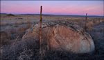
Swallows Rock

Charlie and the rest of the park staff have a nice view of Swallows Rock across the Snake River. Swallows Rock basalt from Pomona and Elephant Mountain flows.

Tuning up the script!