Showing posts with label Lake Missoula. Show all posts

Sunday, November 17, 2013

Rocks on the move: Glacial Erratics, Ice-Rafted Erratics and Lahars

Miscellaneous collection of traveling rocks/boulders I've visited in recent weeks. "Glacial" erratics were moved within glaciers. "Ice-Rafted" erratics were carried by icebergs during the Ice Age Floods. Icebergs holding boulders often grounded along the margins of Ice Age flood channels.

Teresa checks out the BIG rock.
We finally found time to visit the Lake Stevens glacial erratic. This is the largest known erratic left by the Puget lobe of the Cordilleran Ice Sheet [34' tall, 78' long]. Geology blogger Dave Tucker has more details on the Lake Stevens Erratic.
Erratic warning sign.

Other side of BIG rock.
A big thumbs up to the surrounding homeowners!!! Nice little park on streetside of Lake Stevens erratic.
Yeager Rock
Example of a glacial erratic on the east side of the Cascades. No moss or ferns! This photo was taken a couple years ago on the Waterville Plateau. Yeager Rock and many other basalt boulders were carried south by the Okanogan lobe of the Cordilleran Ice Sheet.
Wedgewood Erratic
Teresa inspects the Wedgewood Erratic. According to Wedgewood Erratic Wikipedia page ... This Seattle erratic was an early practice climb location for Jim Whittaker, who became the first American to reach the top of Mount Everest.
"Fantastic Erratic"
A huge erratic south of Lake Sammamish. Too slow with camera ... almost had "Dog for scale" ... he jumped off as I approached.
Should be "Ferntastic". Hard to see the rock.

Teresa Foster enjoys fall hike.

Salmon in Issaquah Creek. Issaquah Salmon Festival.
Salmon working hard in Issaquah Creek.

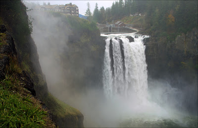
Snoqualmie Falls.
Big flow at Snoqualmie Falls.

Snoqualmie boulders
More on this area in a future post. Great stuff near Twin Falls where ice flowed in from two directions [One from Canada the other from Snoqualmie Pass area].
Use Space Needle to mark maximum Ice Age Flood high water mark? Nope! Too short. Aircraft beacon on top of Space Needle tower is only 605 feet above ground. The Columbia river normal elevation at Vantage is around 570 feet. Largest Ice Age Floods to sweep through the area had a surface elevation greater than 1,263 feet [Ice-rafted erratics have been found at this elevation by State Park rangers].
Nick and I have met several times in recent weeks near Vantage, WA. We're trying to round up video and photos to build a show featuring geology along Interstate 90 between Seattle and Spokane. The drainage on the other side of the river (above) is Ryegrass Coulee. Several ice-rafted erratics sit in Ryegrass Coulee ... hard to find at 70 mph.
"An Iceberg Graveyard"
Nick at Ginkgo State Park visitor center - Vantage, WA. Interpretive panels describes ice-rafted erratics stranded high above the Columbia River.
Teresa and Pasco Basin erratics [ice-rafted] last weekend.

Short video describes Ice-Rafted Erratics

Subscribe to HUGEfloods Channel for new video updates.

Ice-rafted erratic in Ryegrass Coulee.

Back to "Glacial Erratics"
Here's Nick between Ellensburg and Cle Elum - Elk Heights I-90 exit in the distance. The boulder was carried to this location by a huge glacier that was fed by ice flowing from Snoqualmie Pass and the drainages that now hold Lake Kachess and Lake Cle Elum.
Glacial moraine near Thorp, WA
I-90 winds through massive moraine that marks maximum advance of glacier mentioned above. The glacier that left this moraine is from a much earlier time than the recent rounds of Lake Missoula flooding. The 40 mile-long Yakima Glacier existed more than 600,000 years ago.
Tabbert grounded by fog
Tom Tabbert flew over from Spokane to help us shoot video of I-90 cutting through the big moraine. Morning fog at the Ellensburg airport delayed Saturday filming.
TTABS got the footage ... after fog lifted.

Tabbert approaches lower moraine.

Niece Abby sits on Ice-Rafted Erratic in Yakima Valley.

Abby and I were on our way to visit Grandma (Mom) & Grandpa (Dad).
Erratic #1 on map below

Erratics along I-82 just north of Exit 44

Can you help?

These erratics are marked #2 on map below. Impressive boulders near Ice Age Floods margin in Yakima Valley. Erratics marked #1 and #2 were probably stranded by the same iceberg and moved to edge of Ag ground? Anyone know the story or name of orchard owner?

Interstate 82 - Exit 44.

Tom Tabbert and Nick Zentner
Killing time near Thorp lahar while waiting for fog to lift at Bowers Field.
Thorp lahar in distance [Red arrow at left end - white band].
Lahar: Mudflow or debris flow composed of a slurry of pyroclastic material, rocky debris, and water. The material flows down from a volcano, typically along a river valley.
Some amazing traveling rocks out here! The lahar near Thorp, WA is really cool. Material flowed to this location from a volcano that no longer exists near White Pass, WA. Obstacles like Manastash Ridge were not in place when the volcano erupted allowing flow from White Pass to Thorp area.

Rode in on the lahar from SW.

Same rock pictured in previous image [above Jeep].

Tabbert takes a look at lahar and Yakima River.

Geologists believe this pink mass of rock rafted in on the lahar.


Nick and Rick Spencer video featuring Thorp lahar.

Thursday, October 25, 2012

Ice Age Floods Video

Seems to be plenty of video cameras pointed at Ice Age Floods features recently. Nick and I were in need of some aerial footage for a new project we're working on. Our friend Tom Tabbert was willing to help us out.


Tom Tabbert in his DTA Trike.

Tom Foster, Tom Tabbert, Nick Zentner - Quincy, WA airport. Sure was a nice day! Nick and I shot video for a "Coulee" show and another on "Ice Age Waterfalls". Tabbert got some nice aerial video and we found good food in Quincy, WA.

Nick and I have started shooting "2 Minute Geology" educational videos in recent weeks. We hope to have several posted soon. Stay tuned for geology talks by a guy with a blue shirt and red bow tie! I felt the need to explain tie in photo #2.

Tabbert goes through pre-flight checklist while I enjoy a spectacular Ephrata, WA sunrise - iPhone photo.


Check out video above!

Moses Coulee video by Tabbert.

Visit Tabbert's YouTube Channel


The map in this video shows Tabbert flight path during Wednesday and Thursday flights over Moses Coulee, West Bar, Potholes Coulee and Frenchman Coulee.


Trike carries four cameras. Bumpy air can lead to camera vibration issues. The dreaded "bug splats" will also ruin footage.


My favorite camera view is from Camera 4 (wing tip). Here's a Tabbert shot showing Echo Basin. That's me on the coulee rim.

Columnar basalt fly by - Echo Basin.

Tabbert near Island Plateau.


Three photos taken last spring (one above - two below)

Tabbert is able to haul passengers in the trike. I shot photo above while riding with Tom above the Clark Fork River. Here the view is into Montana ... This is the drainage that carried discharge from Glacial Lake Missoula.


Another shot taken over Tom's helmet during a ride-along (passenger sits kinda high in the trike - on top of the fuel tank). Here we're approaching Steamboat Rock in the Grand Coulee.


One last shot from "coach". This time on final descent into Grand Coulee airport.

"2 Minute Geology" video shoot at Dry Falls.

Nick describes the Ice Age Floods during September filming with the British Broadcasting Corporation near Frenchman Coulee. The BBC team shot additional Zentner footage at Dry Falls.

Filming Nick on Echo Basin rim (Frenchman Coulee).

Nick with BBC crew.


We'd all be getting more done ... but ... can't seem to put Bjornstad's new book down!

More Trike Photos

Wednesday, May 27, 2009

National Geologic Trail Press Conference

The Ice Age Floods Institute held a press conference today regarding legislation that was passed by Congress on March 25, 2009, authorizing the Ice Age Floods National Geologic Trail. The legislation is the culmination of a multi-year effort. The primary sponsors of the legislation are U.S. Senator Maria Cantwell and U.S. Congressman Doc Hastings.

Link to Tri-City Herald coverage: Press Conference


Ice Age Floods National Geologic Trail Press Conference speakers Gary Kleinknecht (Ice Age Floods Institute President), U.S. Congressman Doc Hastings and U.S. Senator Maria Cantwell.


Congressman Hastings and Senator Cantwell hold small ice-rafted erratics that were presented by the Ice Age Floods Institute.


Senator Maria Cantwell

“Since 2001, I have been working with communities in Central and Eastern Washington, the National Park Service, and community stakeholders to create an Ice Age Floods National Geologic Trail through portions of Washington, Oregon, Idaho, and Montana,” said U.S. Senator Maria Cantwell. “Visitors to the trail will not only provide an important economic boost to Central and Eastern Washington communities, but they will learn about an amazing, and often overlooked, part of our region’s history.”

Check out the huge erratic boulder above - left side of image. This boulder was ice-rafted to the Badger Mountain area during the Ice Age Floods. Material on the kiosk describes that the erratic was moved to this point during construction of homes a short distance away.


Congressman Doc Hastings

“I was proud to sponsor the legislation establishing the Ice Age Floods National Geologic Trail in the House of Representatives,” said U.S. Congressman Doc Hastings. “It is fitting that the first-ever National Geologic Trail should highlight the unique and dramatic landscape of the inland Northwest, which was shaped by these Ice Age floods. This trail will serve to inform local residents about our unique geologic history, attract and support tourism to the region, and do so by interpreting sites on existing public lands rather than adding new regulations to private landowners or through the costly acquisition of new federal lands.”


Lake Lewis Maximum Elevation 1,250 feet.


The press conference was held in Trailhead Park, (541 Queensgate Dr., Richland) on the slopes of Badger Mountain. As you hike the trail to the top of Badger Mountain, you'll pass this marker placed at the Ice Age Floods high-water line.


View Larger Map

Badger Mountain (lower left) and Queensgate Drive in Richland. Use Google's navigation tools to explore the area.


Bruce Bjornstad created this illustration to show approximate water level during major Ice Age Flood events. Click to enlarge and notice the summit of Badger Mountain became an island surrounded by temporary Lake Lewis.


Keith Dunbar is the National Park Service Chief of Planning for the Pacific West Region.


Kris Watkins, CEO for the Tri-Cities Visitor and Convention Bureau describes tourism opportunities for communities along the trail.


Geologist/Author Bruce Bjornstad

I'm not sure what Bruce is describing here but he's probably explaining a flood feature or giving directions to a hike in the Channeled Scablands.

Bruce's book "On the Trail of the Ice Age Floods" is available at the Ice Age Floods Institute store.


Dale Middleton

It made my day to see Dale at the press conference. Dale has worked hard for many years to make sure that the story of the Ice Age Floods is told.


George Last

George deserves a ton of credit for the Ice Age Floods kiosk and high-water marker along the Badger Mountain trail. George serves as President of the Lake Lewis chapter of the Ice Age Floods Institute.


Terry Hurd is President of the Columbia Gorge chapter of the Ice Age Floods Institute. I'll always appreciate Terry's help and advice when Nick Zentner, Karl Lillquist and I were starting the IAFI chapter in Ellensburg.


Ice-rafted erratic along bike path to Badger Mountain.


Ice Age Floods National Geologic Trail


The Trail will become part of the network of existing public highways through Montana, Idaho, Oregon, and Washington, enabling the public to view, experience, and learn about the features and story of the Ice Age floods through the collaborative efforts of public and private entities.

The Ice Age Floods were the largest documented flood events known to have occurred on Earth. The discharge of water from Glacial Lake Missoula as the ice dam failed equaled ten times the flow of all of the rivers on Earth. The Glacial Lake Missoula contained over 500 cubic miles of water when the ice dam failed.

Learn more about the trail at the Ice Age Floods Institute site:
IAFI Trail Page