Earlier this month, Nick Zentner and I spent a few days in Hawaii filming 2 Minute Geology episodes on Hotspots, Volcano Types and Lava. We also shot "comparison" footage to include in several of our shows related to the Columbia River Basalts. University of Hawaii at Hilo geologist Steve Lundblad was our host and guide. I sure enjoyed meeting members of Hilo's geology department (students and faculty) when Nick gave a talk to that group.
Sunrise iPhone view of Pacific Ocean - Lundblad home. Thanks for everything Steve & Nancy!!!
Nick and Steve filming 2 Minute Geology episode near Saddle Road summit.
Flew from Seattle to Kona. Stayed in Hilo.
 |
Sea Turtle enjoys Hilo Bay |
Rainbow Falls in Hilo is beautiful. A tropical rain-forest climate [with annual rainfall totals in excess of 10 feet] ... allows "houseplants" to grow wild.
What is Lava?
Click above to view flowing lava and watch Nick sample molten lava.
Road over the rock
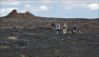
Steve and Nick following University of Hawaii Hilo's volcano field expert Darcy Bevens. Thanks for the great hike Darcy!!!
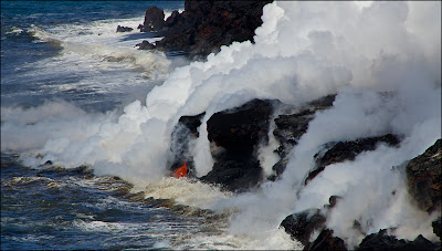
Steam from lava entering ocean in the distance.
Pacific Ocean lava entry
Geologist Nick Zentner explains creation of pillow lavas and palagonite when lava flows into water.
Black sand beach
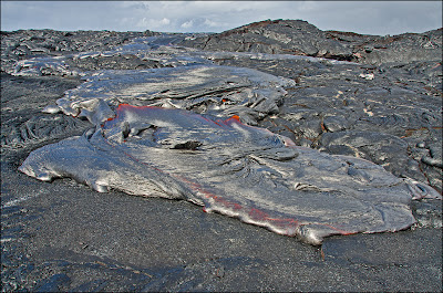
Hot flows are silver in the sun
This feature was really cool!!! My photos don't capture the scene very well. Huge pothole-like holes called "Twin Pits". You can see where the 1974 lava flow spilled into pit on the right.
Sorry Ice Age Floods friends! ... These pits are more impressive than any flood-carved pothole I've seen. It hurts me to say that! Nick for scale at top left.
Volcanic glass threads from erupting volcanos that looks like blonde hair. You can see it in photo above that shows Steve and Nick following Darcy. Pele is the Hawaiian goddess of volcanoes.
The wind helped us out and we only had to wear respirators a short time. Sulfur dioxide released by the erupting volcano is known as vog (slang ... for volcanic fog or smog).
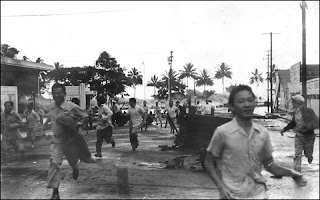
Yikes!!! Hilo's recent tsunami history recorded on this tree. With several bands marking events [date and depth]. The top tag is at 26 ft.
The highest tag marks 26 ft surge in 1946.
The tsunami is believed to have been generated during a magnitude 7.4 earthquake, when a large section of seafloor uplifted in the Aleutian Island chain (scientists are still trying to verify exact location).
USGS photo shows residents running from 1946 tsunami (wave visible in palm trees) that killed 159 people in Hilo.
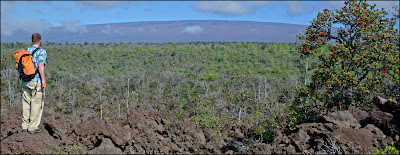
Mauna Loa
The long gentle slopes of Hawaiian shield volcanoes are deceiving. Hard to believe the summit in the distance is 13,679 feet!
I like this one better!!!
Mount Rainier view from plane on the trip home.


